
Sources for Hartford County Previous Residents
A house-history trail needs sources from more than one era. Connecticut's town-and-county structure matters because towns, not a current county recorder, hold the local chain. The current Hartford assessor search identifies a parcel, owner label, mailing address, sale fields, legal reference, and prior-assessment links. The town clerk land index supplies recorded instruments and parties. Historical city directories can place a printed name at a street, while reverse directories and Sanborn maps help translate old numbers. Newspapers, probate, vital records, and cemetery archives can corroborate a move, death, inheritance, or family link.
| Source | Years It Covers | Where Held | What It Shows |
|---|---|---|---|
| Hartford assessor and prior cards | Current assessment cycle; next revaluation scheduled October 1, 2026 | Hartford Assessor | Parcel, owner, mailing, value, sale, use, and physical fields |
| Hartford land index | Current help reports index from 1/2/1964; image coverage varies | Hartford City Clerk / SearchIQS | Deeds, maps, liens, mortgages, parties, book/page, and instruments |
| Geer and Gardner directories | 1838-1929 | HPL, NYPL, libraries, FamilySearch | Printed household, business, street, and occupation associations |
| Town and City Clerk Archives | 1635-2010; strongest 1839-1947 | Hartford History Center | Municipal archives, maps, directories, and finding aids |
| Sanborn and reverse directories | Year-specific; Hartford Sanborn example 1922-August 1950 | LOC and established libraries | Footprints, street segments, numbers, uses, and address-first clues |
The table is a route map, not a claim that every year is online. A missing edition, image, or index needs a library, clerk, archive, or reference request.
Start With Hartford County's Parcel Record
Record the current owner label, parcel ID, situs, mailing address, build narrative, value, sales, legal reference, and links to previous assessment or sales pages. The Hartford sample at 1 Main St Unit N1 uses parcel 248-555-060, identifies an LLC owner, places the mailing address on Woodland Drive, and lists legal reference 08200 0287. It is a commercial condo-office account with zero beds and baths.
That example prevents a common mistake. The situs says where the property is. The mailing address says where assessment mail goes. The owner label may be an entity. The legal reference points to the next record. None alone proves who occupied the unit or who lived at the mailing address.
- Write down the parcel ID, situs, owner label, mailing address, sale date, legal reference, and prior-assessment links.
- Use the book/page or instrument reference in the town or city clerk land index.
- Read the current deed, then search its seller as a grantee to locate that seller's earlier purchase.
- Check the legal description, parcel continuity, dates, and party roles at each earlier transfer.
- When an image or older entry fails, ask the clerk for paper-book or mail access and mark the break.
- Chain of title
- The sequence of recorded transfers or interests that links a parcel through time.
- Grantor
- The party shown as transferring an interest.
- Grantee
- The party shown as receiving an interest.
- Legal description
- The written property description used in an instrument, which may be more stable than a street number.
- Criss-cross directory
- A reverse directory arranged by street and house number, letting a known address lead to a printed name.
- Enumeration district
- The census area assigned to an enumerator, useful for checking whether an old address falls in the same local area.
Follow the Hartford County Deed Record Back
Use the assessment card’s book and page, instrument, date, parcel, or party reference in the municipal land index. Hartford’s SearchIQS help reports land-record index coverage from January 2, 1964, with images from July 1, 1991 forward. An older vendor PDF reports index-only coverage through December 27, 2001 and images beginning December 28, 2001. The two sources conflict, so preserve both dates and ask the clerk when an image is missing.
The current portal offers guest or index access and vendor account options. A town clerk can help with a mail or in-person image request. Ask narrowly with parties, date, parcel, book and page, and instrument type. Another Hartford County town may use a different vendor or portal. If the chain crosses town lines, branch to the next clerk instead of treating the county as one land-record book.
The SearchIQS Hartford coverage help makes index and image coverage a dated research question, not a silent assumption.
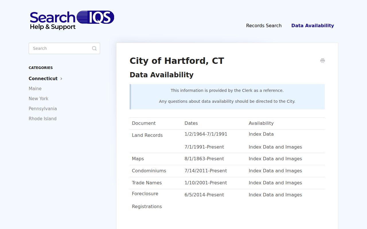
The capture separates index data from viewable images. A missing image should lead to the clerk fallback, not a conclusion that no deed exists.
Note: An index citation can survive an image outage, so preserve the book, page, date, parties, and clerk request path.
Hartford County Owner and Occupant Records
Ownership can diverge from occupancy. A deed may list an LLC, trust, authority, executor, trustee, mortgagee, or attorney. A mixed-use parcel may have no household, and its mailing address may be elsewhere. A directory may list a business office; a voter registration may be protected, inactive, or not current.
State the narrow result: “the card lists this owner label on its date,” or “the index shows this party in this instrument.” Add a dated directory, newspaper, vital, probate, or archival record before linking a person to a past household. Do not guess from a similar surname.
Compare Hartford County Assessment Records
Prior assessment links can show how an owner label, mailing address, building use, sale, value, or narrative changes. The assessment date matters. Hartford’s assessor search identifies October 1, 2021 as the last revaluation and October 1, 2026 as the next scheduled revaluation. A value or classification can change when the Grand List changes even if the parcel identity remains.
Make a small dated ledger: card year, owner, mailing, situs, use, assessment, sale, legal reference, and source URL. Compare it with the deed instrument, not with a loose search result. Fiscal data describes assessment; the clerk’s instrument describes the recorded transaction.
Hartford County GIS and Address Records
Hartford GIS can show parcel geometry, address points, roads, buildings, CAMA, tax maps, zoning, historic districts, FEMA, and voting layers. The digital-data hub lists parcel dimensions, acreage, labels, address points, buildings, roads, hydrography, sidewalks, parking, driveways, contours, and downloadable formats. Compare layers by date to look for a lot split, merge, changed road name, or address point that explains why a directory line does not match a modern card.
GIS translates rather than defines a legal boundary. Record layer names, access date, and map product. Outside Hartford city, repeat the work with the actual town’s GIS or assessor.
Note: Parcel geometry, address points, and civic boundaries may change on different schedules, so record each layer and access date.
Hartford County Permit and Plan Records
Hartford Accela can search record number, type, date range, license, name, business, parcel, street, unit, city, state, and ZIP. Record types include building, demolition, electrical, fire suppression, mechanical, plumbing, additions, alterations, new construction, pools, solar, and temporary structures. A permit can date a change to a building or lot and may name an applicant, contractor, or professional. It does not identify every person who used the property.
GIS inspector, permit, and scanned-document viewers are fallbacks. Ask for a record number, parcel, drawing, or date. Pair older work with a Sanborn map or assessor narrative. A written request under Connecticut public-records law can target a specific non-exempt file.
Hartford County Historical Directories
Gardner and Geer city directories run from 1838 through 1929, with later volumes expanding to West and East Hartford. FamilySearch offers an 1860-1861 scan. Hartford Public Library’s History Center holds city directories, maps, yearbooks, photographs, municipal archives, and newspapers, while its Town and City Clerk Archives span 1635-2010 with most material from 1839-1947. Use the collection to find a year and page, not to claim continuous residence.
The 1799 directory reprint uses landmarks and street segments. Reverse or criss-cross directories search from a street or number. A directory may record a business, office, boarding place, or household head. The Hartford County city directory collections page explains the shelf and how to read these variations.
- Translate the modern parcel and street into the historic municipality, ward, and street spelling.
- Pair a directory year with the nearest available public census year and compare the enumeration district.
- Record the printed address, household names, edition, scan or call number, and any OCR or numbering doubt.
Hartford County Sanborn Address Records
The Library of Congress Hartford Sanborn example covers 1922 through August 1950 and identifies a sheet with building and street context. Sanborn maps can show footprint, construction, street name, block or house number, utilities, and use. They help align a historical directory entry with a parcel or block when a number changed. They do not prove who lived in a building.
The Library of Congress reverse-directory guide recommends a request with location, type, and year. If a volume is not online, use a library catalog, reading room, microfilm, or reference request. State the translation step and uncertainty.
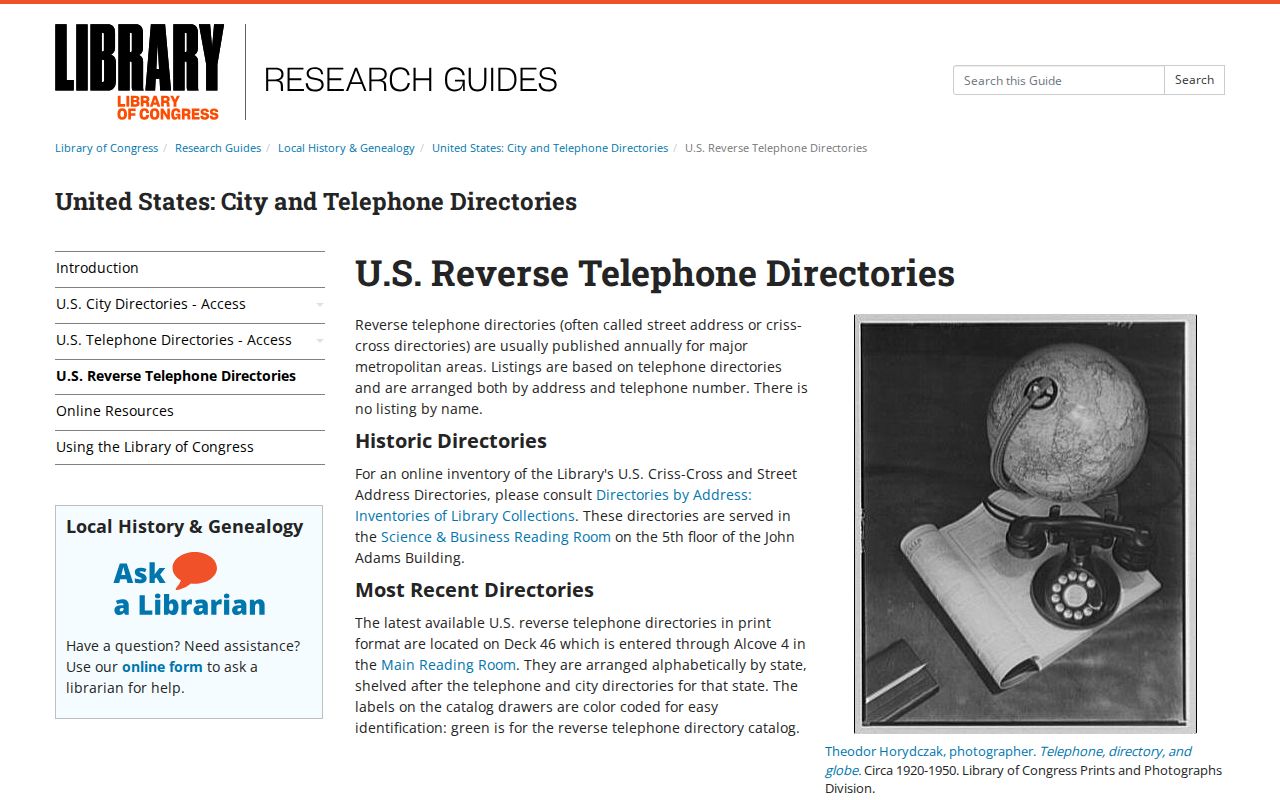
The reverse-directory capture shows the address-first method. It can connect a known street and number to a printed name, but availability, request limits, and advance notice vary by holding library.
The Library of Congress Sanborn map guide explains the building and street symbols used to read a map. The Hartford 1950 sheet is the local comparison point, identified in the research as Volume 3, 1922-August 1950, sheet 70.

The Sanborn capture helps translate footprints, street alignment, block or house numbers, utilities, and nearby structures. It adds physical history, not proof of a current resident.
Note: A historic footprint can resolve a location question without proving the identity or continuous presence of any household.
Hartford County Probate and Vital Records
A past household often leaves different traces at different moments. A death notice may name a relative or former address. The Connecticut Probate case lookup may show an estate or executor. A vital record may confirm a death, marriage, or birth when the requester is eligible. A cemetery archive may locate an interment. Connecticut DPH and the town registrar remain the route for certified copies, while newspapers and libraries supply historical context.
Hartford has no standalone official obituary-name index located in the research and no complete official online cemetery-name search. The documented fallbacks are HPL clippings and newspapers, state library holdings, Parks and Cemetery staff, local clerks, genealogical reference help, and established archives. A gap should be reported as a gap.
Cite the resident trail. Save the instrument or directory reference, date, town, parcel or street, page, URL, and access path. Mark missing images, spelling variants, uncertain landmarks, entity ownership, and edition gaps. Deeds show transfers, and directories show printed associations, not continuous residence.
House-history limit. Hartford County previous residents research is for lawful personal and family-history use. Do not use a past address, name, deed, court, or directory entry to stalk, harass, threaten, or harm anyone.
When the goal shifts to the current street or parcel, use the Hartford County by-street records and start a new dated search rather than merging past and present people.